Jump to content

Fail:African continent-en.svg

Page contents not supported in other languages.
Long Wikipedia

Bikpela piksa (SVG file, nominally 1,525 × 1,440 pixels, file size: 752 KB)

This file is from Wikimedia Commons and may be used by other projects. The description on its file description page there is shown below.

Description
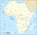
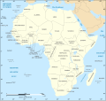
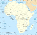
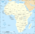
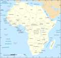
English: Map of the African continent as in 2011-07.
Français : Carte en anglais du continent africain tel qu'en 07/2011.
Lambert azimutal equal-area projection, WGS84 datum, standard meridian: 15°E, standard parallel: 0°
Scale: 1:15,000,000 (accuracy: 3,75 km)
Date (UTC), updated 2011-07
Source
Author
Other versions

Derivative works of this file:

[senisim]


Map close to Africa map political-fr.svg, but with some changes on the islands administrated by European countries and the Sinai peninsula
SVG genesis
InfoField
 
The SVG code is valid.
 
This map was created with Inkscape, or with something else.
 
 This map uses embedded text that can be easily translated using a text editor.
This is a retouched picture, which means that it has been digitally altered from its original version. Modifications: English translation. The original can be viewed here: African continent-fr.svg. Modifications made by Bobarino.

I, the copyright holder of this work, hereby publish it under the following license:
w:en:Creative Commons
attribution share alike
This file is licensed under the Creative Commons Attribution-Share Alike 2.5 Generic, 2.0 Generic and 1.0 Generic license.
You are free:
  • to share – to copy, distribute and transmit the work
  • to remix – to adapt the work
Under the following conditions:
  • attribution – You must give appropriate credit, provide a link to the license, and indicate if changes were made. You may do so in any reasonable manner, but not in any way that suggests the licensor endorses you or your use.
  • share alike – If you remix, transform, or build upon the material, you must distribute your contributions under the same or compatible license as the original.

Original upload log

This image is a derivative work of the following images:

  • Image:Africa_map_blank.svg licensed with Cc-by-sa-2.5,2.0,1.0, Cc-by-sa-2.5,2.0,1.0/en
    • 2008-06-27T03:34:58Z Sting 1525x1440 (711453 Bytes) Completely new drawing with known projection
    • 2006-05-31T15:28:42Z Sting 1390x1295 (571519 Bytes) Enhanced version : African and Asian continents separated
    • 2006-05-31T03:53:32Z Sting 1390x1295 (566642 Bytes) {{Information |Description=Blank vector graphic map of [[:Category:Maps of Africa|Africa]] |Source=Several bitmap-type maps |Date= May 2006 |Author= Eric Gaba ({{U|Sting}}) |Permission=GFDL or CC-BY-SA |other_version

Uploaded with derivativeFX

Captions

Add a one-line explanation of what this file represents

Items portrayed in this file

depicts Inglis

media type Inglis

image/svg+xml

checksum Inglis

bdbf5b896b4004dcee6dcd5beeb3c372354e3d1d

data size Inglis

769,588 byte

height Inglis

1,440 pixel

width Inglis

1,525 pixel

Ol senis bilong dispela fail

Click on a date/time to view the file as it appeared at that time.

De/TaimLiklikOl saisYusaTingting
bilong nau18:21, 6 Disemba 2020Thumbnail for version as of 18:21, 6 Disemba 20201,525 × 1,440 (752 KB)StingSwatziland => eSwatini
19:59, 14 Julai 2011Thumbnail for version as of 19:59, 14 Julai 20111,525 × 1,440 (752 KB)StingSudan/South Sudan 2011-07 border update
16:42, 16 Disemba 2010Thumbnail for version as of 16:42, 16 Disemba 20101,525 × 1,440 (747 KB)StingSpelling correction: Madeira
20:16, 10 Janueri 2009Thumbnail for version as of 20:16, 10 Janueri 20091,525 × 1,440 (747 KB)StingCorrection Sao Tome
08:37, 6 Disemba 2008Thumbnail for version as of 08:37, 6 Disemba 20081,525 × 1,440 (750 KB)Bobarino{{Information |Description={{en|Map of the African continent.}} {{fr|Carte vierge du continent africain.}} Lambert azimutal equal-area projection, WGS84 datum, standard meridian: 15°E, standard pa

There are no pages that use this file.

Global file usage

The following other wikis use this file:

Metadata