
Fail:Philippines relief location map (Mindanao).svg

Size of this PNG preview of this SVG file: 656 × 486 pixels. Other resolutions: 320 × 237 pixels | 640 × 474 pixels | 1,024 × 759 pixels | 1,280 × 948 pixels | 2,560 × 1,897 pixels.
Bikpela piksa (SVG file, nominally 656 × 486 pixels, file size: 2.21 MB)
.svg)
Liklik toksave bilong senis
| Description |
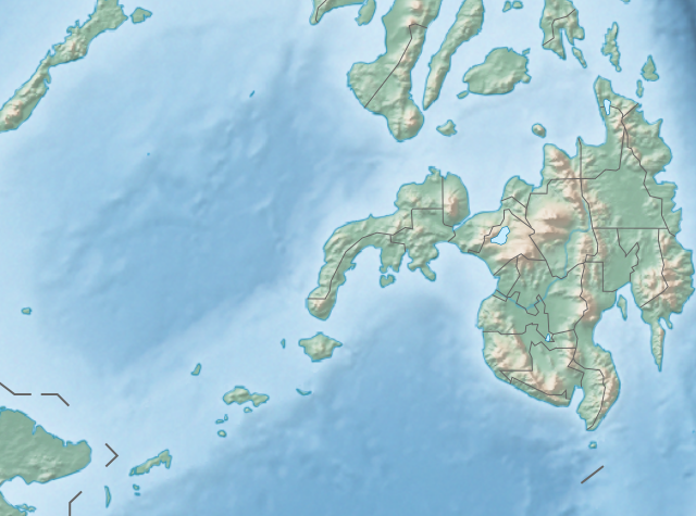
English: Physical location map of the Philippines (Mindanao)
Equirectangular projection based on the parallel of 10°43' N
|
| Date | |
| Source | File:Philippines location map (square).svg |
| Author | User:Hellerick |
| Other versions |
This file was derived from: Philippines relief location map (square).svg: .svg) |
.svg)
Laisens
This file is licensed under the Creative Commons Attribution-Share Alike 3.0 Unported license.
- You are free:
- to share – to copy, distribute and transmit the work
- to remix – to adapt the work
- Under the following conditions:
- attribution – You must give appropriate credit, provide a link to the license, and indicate if changes were made. You may do so in any reasonable manner, but not in any way that suggests the licensor endorses you or your use.
- share alike – If you remix, transform, or build upon the material, you must distribute your contributions under the same or compatible license as the original.
Ol senis bilong dispela fail
Click on a date/time to view the file as it appeared at that time.
| De/Taim | Liklik | Ol sais | Yusa | Tingting | |
|---|---|---|---|---|---|
| bilong nau | 14:36, 27 Oktoba 2017 | | 656 × 486 (2.21 MB) | Mliu92 | Updated crop to add missing island. |
| 17:23, 26 Oktoba 2017 |  | 573 × 573 (2.21 MB) | Mliu92 | User created page with UploadWizard |
Ol fail link
There are no pages that use this file.
Global file usage
The following other wikis use this file:
- Usage on bcl.wikipedia.org
- Usage on bn.wikipedia.org
- Usage on en.wikipedia.org
- Sulu Sea
- Moro Gulf
- Mount Apo
- Davao Gulf
- Iligan Bay
- Panguil Bay
- Bud Dajo
- Mount Butung
- Agusan River
- Lake Lanao
- Rio Grande de Mindanao
- Butuan Bay
- Mount Agad-Agad
- Mount Hibok-Hibok
- Mount Makaturing
- Mount Matutum
- Musuan Peak
- Agus River
- Sibuguey Bay
- Illana Bay
- Mount Sumagaya
- Dinagat Island
- Davao River
- Leonard Kniaseff
- Mount Kitanglad
- Macajalar Bay
- Pulangi River
- Cagayan River (Mindanao)
- Mount Dulang-dulang
- Tagoloan River
- Lake Buluan
- Lake Wood (Philippines)
- Lake Dapao
- Mount Malindang
- Mount Kalatungan
- Latukan
- Mount Balatukan
- Mount Hamiguitan
- Mount Baya
- Agusan Marsh Wildlife Sanctuary
- Camp General Basilio Navarro
- 2010 Mindanao earthquakes
- Manupali River
View more global usage of this file.
.svg)
.svg)