
Fail:Provincias de España.svg

Size of this PNG preview of this SVG file: 644 × 458 pixels. Other resolutions: 320 × 228 pixels | 640 × 455 pixels | 1,024 × 728 pixels | 1,280 × 910 pixels | 2,560 × 1,821 pixels.
Bikpela piksa (SVG file, nominally 644 × 458 pixels, file size: 1.65 MB)
Liklik toksave bilong senis
| Description |
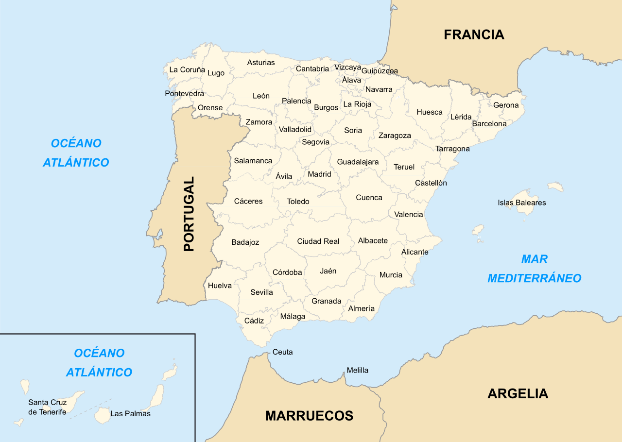
Español: Mapa de las provincias de España.
Português: Mapa das províncias de Espanha (em espanhol). |
||||||||
| Date | |||||||||
| Source | Own work | ||||||||
| Author | |||||||||
| Permission (Reusing this file) |
|
||||||||
| Other versions |
This file was derived from: Provinces of Spain.svg |


|
This SVG file contains embedded text that can be translated into your language, using any capable SVG editor, text editor or the SVG Translate tool. For more information see: About translating SVG files. |
Ol senis bilong dispela fail
Click on a date/time to view the file as it appeared at that time.
| De/Taim | Liklik | Ol sais | Yusa | Tingting | |
|---|---|---|---|---|---|
| bilong nau | 11:08, 23 Septemba 2021 | | 644 × 458 (1.65 MB) | Lojwe | mejoro posicionamiento del texto de las provincias canarias |
| 17:57, 22 Septemba 2021 |  | 644 × 458 (1.66 MB) | Lojwe | corrijo error importante sobre la delimitación de la provincia de Las Palmas y retiro marco | |
| 21:22, 4 Me 2020 |  | 644 × 458 (1.68 MB) | Snooze123 | añadida separación entre las provincias canarias | |
| 19:11, 5 Janueri 2007 |  | 644 × 458 (1.68 MB) | Darz Mol~commonswiki | ||
| 19:07, 5 Janueri 2007 |  | 644 × 458 (1.35 MB) | Darz Mol~commonswiki | == Summary == {{Information |Description={{Spanish}} Mapa de las provincias de España. |Source= Own work |Date= 5 January 2006 |Author= Emilio Gómez Fernández (mapa original)<br>Darz Mol (nueva versión) |
Ol fail link
Dispela pes i link long dispela fail:
Global file usage
The following other wikis use this file:
- Usage on ast.wikipedia.org
- Usage on br.wikipedia.org
- Usage on bs.wikipedia.org
- Usage on de.wikipedia.org
- Usage on en.wikipedia.org
- Usage on es.wikipedia.org
- Usage on eu.wikipedia.org
- Usage on fa.wikipedia.org
- Usage on fr.wikipedia.org
- Usage on gag.wikipedia.org
- Usage on io.wikipedia.org
- Usage on ka.wikipedia.org
- Usage on la.wikipedia.org
- Usage on mk.wikipedia.org
- Usage on ps.wikipedia.org
- Usage on ro.wikipedia.org
- Usage on sr.wikipedia.org
- Usage on to.wikipedia.org
- Usage on xmf.wikipedia.org