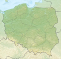
Fail:Relief Map of Poland.png
Appearance

Size of this preview: 617 × 600 pixels. Other resolutions: 247 × 240 pixels | 494 × 480 pixels | 1,000 × 972 pixels.
Bikpela piksa (1,000 × 972 pixels, file size: 1.46 MB, MIME type: image/png)
Ol senis bilong dispela fail
Click on a date/time to view the file as it appeared at that time.
| De/Taim | Liklik | Ol sais | Yusa | Tingting | |
|---|---|---|---|---|---|
| bilong nau | 18:02, 28 Ogas 2010 |  | 1,000 × 972 (1.46 MB) | Виктор В | рельеф дна |
| 12:08, 28 Ogas 2010 |  | 1,000 × 972 (1.43 MB) | Виктор В | == {{int:filedesc}} == {{Information |Description={{en|Relief map of Poland}} Equirectangular projection, N/S stretching 160 %. Geographic limits of the map: * N: 55.2° N * S: 48.7° N * W: 13.8° E * E: 24.5° E |Source=*[[:File:Poland lo |
Ol fail link
Dispela pes i link long dispela fail:
Global file usage
The following other wikis use this file:
- Usage on ar.wikipedia.org
- Usage on as.wikipedia.org
- Usage on av.wikipedia.org
- Usage on be-tarask.wikipedia.org
- Usage on be.wikipedia.org
- Буг
- Нараў
- Шаблон:На карце/Польшча
- Вісла
- Чорная Ганча
- Марыха
- Вепш
- Бебжа
- Ганьча (возера)
- Шлямы
- Белавежскі нацыянальны парк
- Мамры
- Снярдвы
- Свентакшыскія горы
- Снежка
- Піліца
- Віслока
- Рысы
- Рэга
- Варта
- Тарніца
- Нотаць
- Пэлхаўка
- Палескі нацыянальны парк
- Дзіўна
- Волін (востраў)
- Вігерскі нацыянальны парк
- Вігры
- Свіна (Польшча)
- Сабяшэўскі востраў
- Блэндоўская пустыня
- Велка-Снежна пячора
- Марское Вока
- Лыса-Гура (Свентакшыскія горы)
- Ніда (рака)
- Язёрак
- Бебжанскі нацыянальны парк
- Востраў збожжасховішчаў
View more global usage of this file.


